
The preferred cable corridor route for the proposed Awel y Môr windfarm has been announced today, 28th January 2021. The full announcement can be viewed on the project website here and is summarised below.
Preferred Cable Corridor Route
The preferred cable corridor route runs to from the proposed windfarm site to the east, between the existing Gwynt y Môr and Rhyl Flats windfarms, before making a landfall between Rhyl and Prestatyn. The export cables would be located within this corridor (see map below).
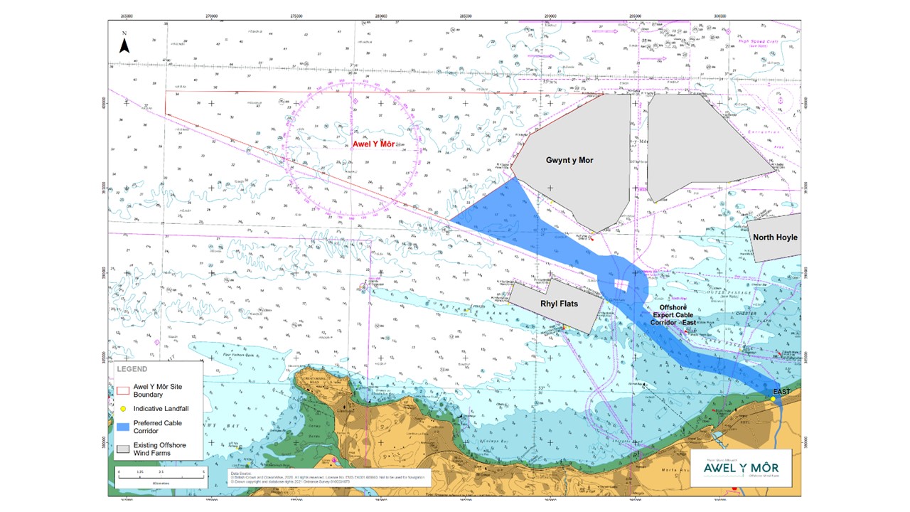
Preferred export cable corridor for proposed Awel y Môr Offshore Wind Farm [Click map to open]
A detailed map of this route as well as the cable route on land is available on the project website here.
The selection of this preferred route follows the public consultation carried out in late 2020; evaluation of results from environmental studies and feedback from technical and statutory consultees.
Further consultation on the project is planned for later this year when the Awel y Môr team will consult on a Preliminary Environmental Information Report. This will include further detail on the transmission cable corridor and project substation. The team expects to submit its application to the Planning Inspectorate in 2022.
About Awel y Mor
Awel y Môr Offshore Wind Farm is a project being developed by RWE to the west of the existing Gwynt y Môr Offshore Wind Farm. It is located approximately 10.5km off the North Wales coast in the Irish Sea, with a maximum total area of 106km². Full details of the proposal can be found at the project website, awelymor.cymru.